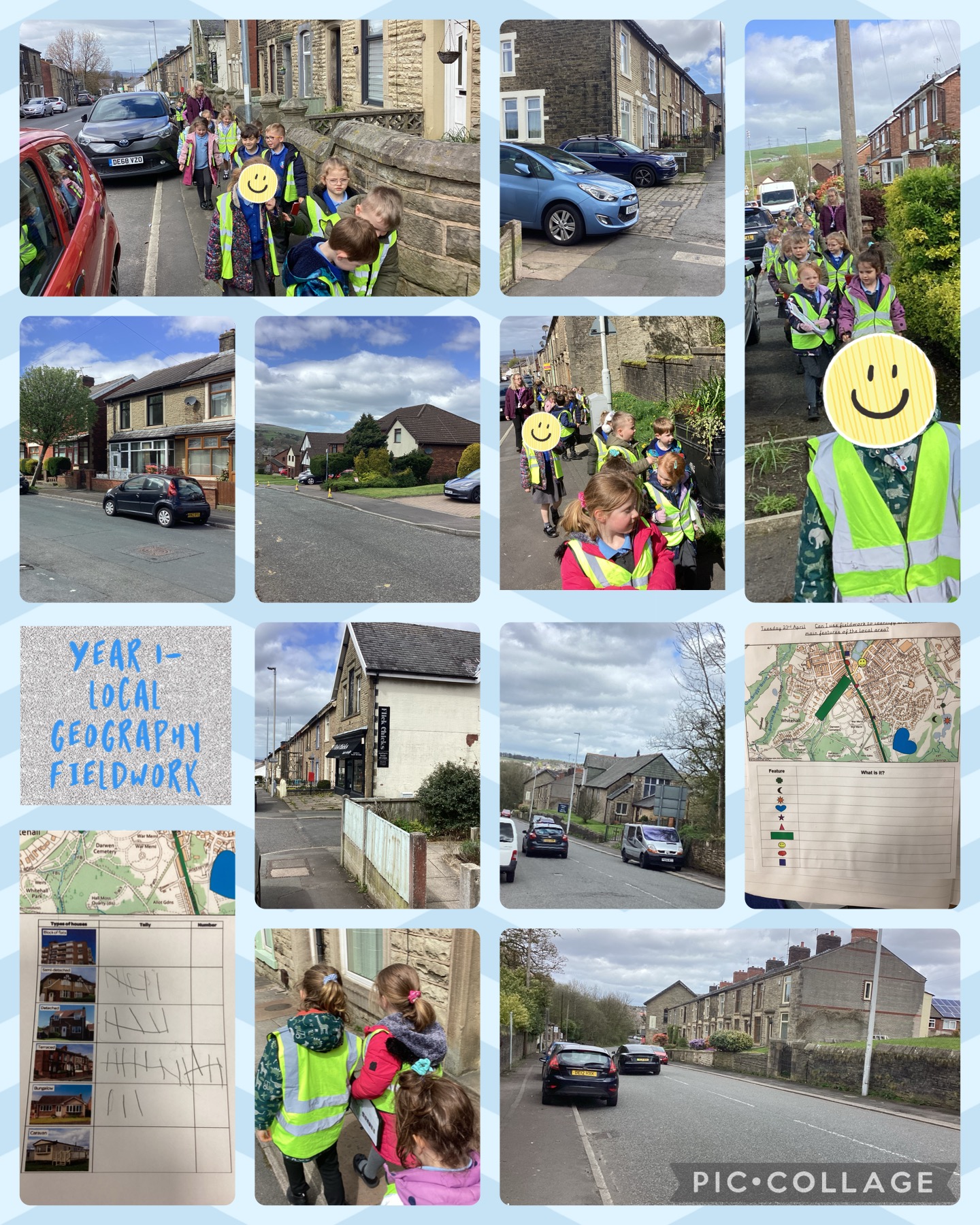
Year 1 are studying their local area as part of their most recent geography unit. Yesterday, they were busy exploring their local area with the help of a map. There were various symbols on the map and they had to investigate what human features the symbols were representing e.g. Whitehall Park, Bolton Rd Laundrette, St Barnabas Church and the cemetery. As part of their fieldwork, they also identified and created a tally of the types of houses that they could see on route e.g. terraced, detached, semi-detached and bungalows. When we got back to school, we discussed what types of houses were most popular in the area of Whitehall and we came to the conclusion that it was terraced houses. We thought that this might be because we can fit more terraced houses into a small area which means that more people can live there. We also linked this back to our previous learning on the Victoria era when Darwen was a very popular cotton town. We thought that maybe Darwen would have needed to provide somewhere for all the factory workers to live in those times hence why there are so many terraced houses.